

Big Firescald Knob
4.5 Miles – Hard
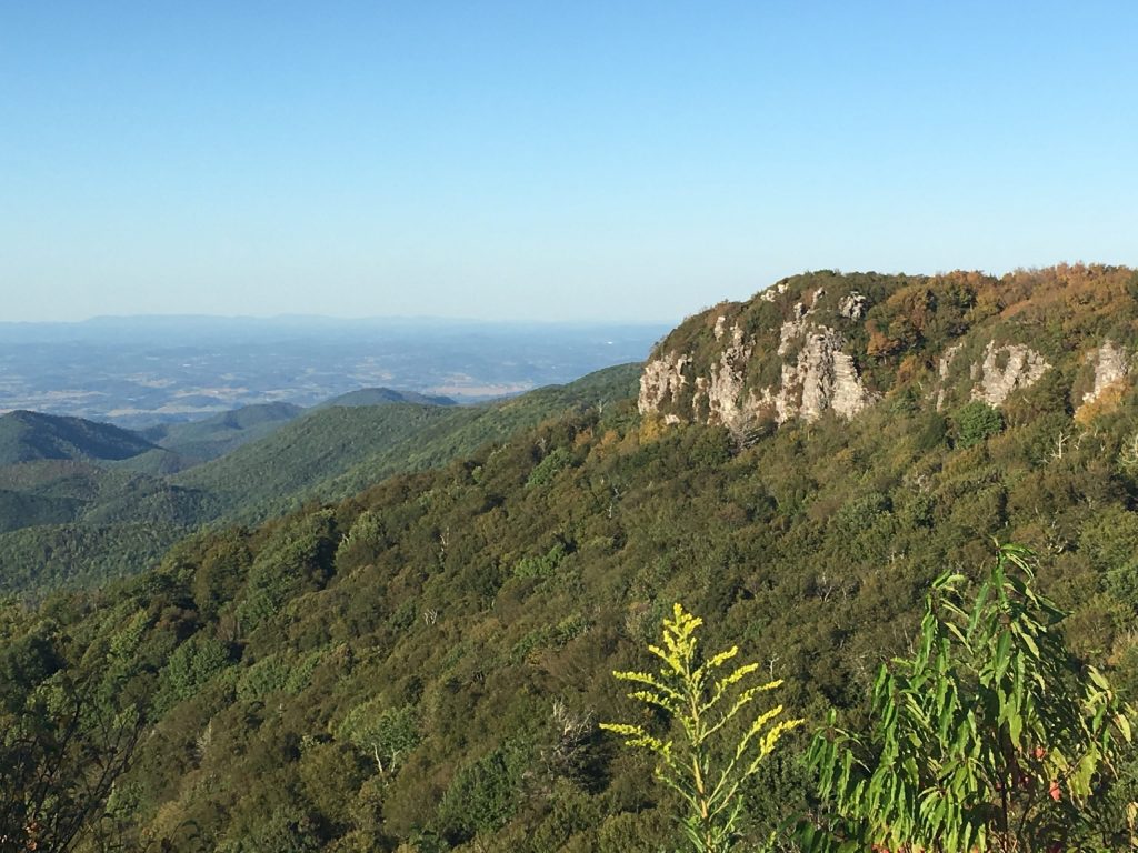
The hike at Big Firescald Knob is a beautiful and challenging hike that showcases stunning 360 degree views of the Appalachian Mountains and long range views of Tennessee.
Trail Description
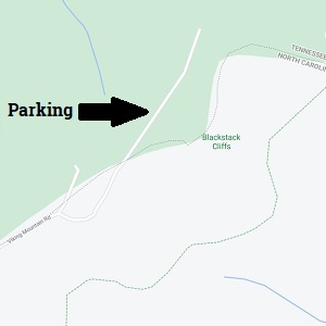
At the parking area you can clearly see the magnificent Blackstack Cliffs to the Northeast. Looking at the Blackstack Cliffs, the trail begins with a gentle descent heading in the direction of the distant cliffs. In approximately 400 feet the trail intersects with a rocky, wide road. Turn left on this road and follow it up the hill and you’ll meet several blue-blazed trails. Follow the left blue-blazed trail for approximately 500 feet where it will then intersect with the white-blazed Appalachian Trail. Turn left on the Appalachian Trail.
Continue on the Appalachian trail and in approximately 300 feet there is blue-blazed trail that hikers can take to enjoy some scenic view points on the Blackstack Cliffs. The viewpoint to get the Black Cliffs is only about 400 feet down the blue-blazed trail. Be careful when atop the cliffs, you can see the parking area here if you look back southward.
The main hike continues back on the white-blazed Appalachian Trail. This section of the Appalachian Trail is extremely rocky and rooty, be careful when hiking. Continue heading Northeast until reaching the “Bad Weather” blue-blazed trail.
This is the beginning of the loop, follow the Blue-blazed “Bad Weather” trail for nearly 1.5 miles where it then intersects again with the “Exposed Ridge” white-blazed Appalachian Trail. Turn right onto the “exposed Ridge” trail, hikers are now heading back south towards the start of the hike. This section begins the main highlight of the hike as the “Exposed Ridge Trail” takes hikers along the ridge of the mountains for spectacular views of the Appalachian mountains and Tennessee.
FAQ
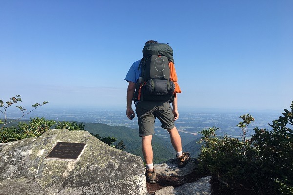
Some locations on the “Exposed Ridge Trail” are extremely rocky and dangerous. Please take caution when traversing through this section of the hike.
Howard’s Rock is located at approximately 3.5 miles into this hike. This is a great spot to relax, have a snack and drink some water before finishing the loop and heading back to the parking area.
Approximately 0.75 miles past Howard’s Rock the trail intersects with the blue-blazed “Bad Weather Trail” again which ends the loop.
Continue following the white-blazed Appalachian trail until reaching the blue-blazed intersection directing to Jones Meadow. Take this blue-blazed trail which then joins with the wide, rocky road at the beginning of the hike. Lastly, follow the small trail up the meadow back towards the parking area to finish the hike.
PLEASE NOTE: Respecting nature is an essential responsibility we bear as inhabitants of this planet. By treating nature with reverence and care, we acknowledge its intrinsic value and the profound impact it has on our lives. It involves mindful consumption, minimizing waste, and adopting eco-friendly alternatives. Embracing nature’s beauty and power, we strive to preserve its pristine landscapes, clean air, and pure waters for future generations. Please be mindful when hiking our trails, rafting our rivers and exploring our beautiful mountains. Please leave no trace and respect the nature of Madison County, North Carolina during your visit. Click here to find out more about respecting nature in Madison County, NC.
Directions
Driving from Asheville: Take I-26 W towards Weaverville for 8 miles. Take exit 19A onto US-25 N/ US-70 W towards Marshall for 21 miles. Continue straight on NC-208 N for 9 miles. Turn right onto Viking Mountain Road which turns into a gravel road named Bald Mountain Road in 5 miles. Continue until reaching a short stretch of pavement and the parking area for the hike. If you can see the Blackstack Cliffs to the Northeast then you are in the correct area to park.
**Caution – The gravel road leading to the parking area is VERY rocky.