

High Rock
3.3 Miles – Moderate
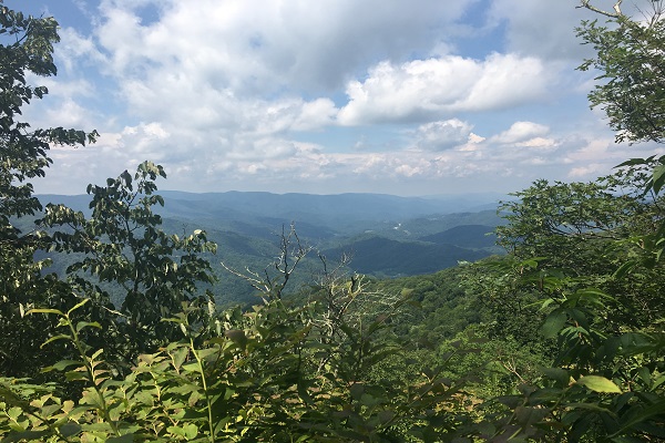
Sam’s Gap to High Rock is a hilly and shady hike that boasts a dramatic view at the perch along the Appalachian Trail.
Trail Description
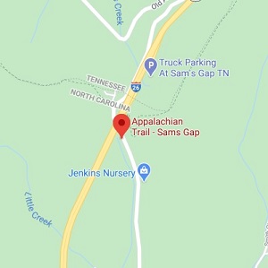
After parking at the Sam’s Gap parking lot, hikers should walk north under the overpass, and the start of the hike begins at the white blazed Appalachian Trail on the left. If you get up to the cemetery you’ve gone too far up the hill. Fenced-in utility equipment adjacent to the trail will confirm you are on the correct path.
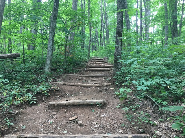
The hike begins with a moderately steep climb into the shady woods, no sunscreen needed for this hike! Much of the first half of this hike will be uphill with sections of flat areas and slight dips. This part of the Appalachian trail is well-maintained and mostly single-track. Hikers will encounter rocky and rooty sections of the trail throughout this hike.
At approximately 0.5 miles into the hike the trail encounters the Moye Rest Monument, which calls for peace and gentle rest on this section of the Appalachian Trail.
The next mile of the trail consists of rolling hills with a steeper climb when nearing the High Rock trail junction.
At 1.75 miles into the hike you’ll reach the sign pointing towards High Rock. Follow the blue blazes off the Appalachian Trail for approximately 300 feet to reach the High Rock viewpoint. The viewpoint itself is a massive rock that awkwardly rests at the end of the blue blazed trail. Hikers should be cautious when walking on it, as it is sloped and the terrain here is uneven.
This is a great point to have a snack, drink some water and enjoy the view.
Once ready, follow the blue blazed trail back to the white blazed Appalachian Trail and begin the journey back on the way hiked in.
FAQ
PLEASE NOTE: Respecting nature is an essential responsibility we bear as inhabitants of this planet. By treating nature with reverence and care, we acknowledge its intrinsic value and the profound impact it has on our lives. It involves mindful consumption, minimizing waste, and adopting eco-friendly alternatives. Embracing nature’s beauty and power, we strive to preserve its pristine landscapes, clean air, and pure waters for future generations. Please be mindful when hiking our trails, rafting our rivers and exploring our beautiful mountains. Please leave no trace and respect the nature of Madison County, North Carolina during your visit. Click here to find out more about respecting nature in Madison County, NC.
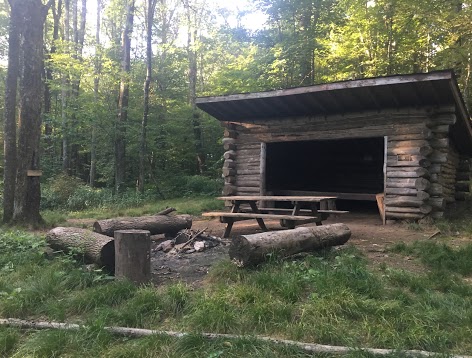
Hogback Ridge Shelter
For hikers interested in extending this hike further, the Hogback Ridge Shelter is 0.75 miles further along the Appalachian Trail.
The Hogback Ridge Shelter is a well-kept log shelter that can sleep 6 people. During peak thru-hiking season this cabin is frequently full of travelers hiking the entire Appalachian Trail. There is also a picnic table and fire ring outside the cabin. This is a great spot to stop for a quick lunch in the woods.
Did you know that there are over 260 hiking shelters along the entire Appalachian Trail? On average, that’s approximately 1 shelter every 8.5 miles!
Directions
Driving from Asheville: Take I-26 W towards Weaverville for 25 miles. Take exit 3 and turn right onto ALT 23 over the bridge. At the next intersection turn left on US 23A. In 3 miles you’ll reach the I-26 overpass and the parking area.