

Laurel River Trail
7 Miles – Easy
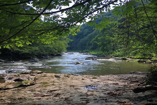
The Laurel River Trail is a relaxing out-and-back trail that follows the breath-taking Laurel River on an old railroad bed. This is an excellent hike that is easy and fun for the whole family. There are many peaceful spots along the trail to access the river and cool off.
Trail Description
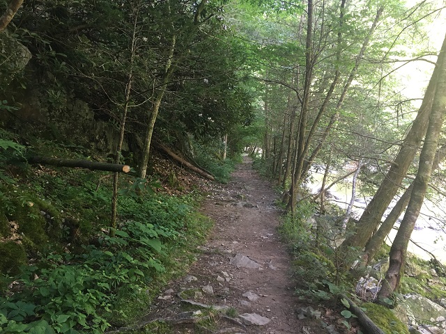
The Laurel River Trail is a popular trail so plan your trip accordingly to beat the crowds! There are sections of this hike that are extremely rocky and rooty. Despite the trail being very flat you will need to pay attention to where you’re stepping.
The hike begins with a gentle decline down to the Laurel River; follow the yellow blazes. The first mile of the hike is on private property so please be respectful, stay on the trail and do not litter.
The trail hugs the Laurel River and takes hikers along steep cliff sides and through tunnels of rhododendrons. Anglers commonly wade into this section of the river to try their luck at catching trout. The Laurel River is also ranked as Class III/IV rapids. Kayakers and white water rafters can occasionally be seen enjoying the flow.
The trail continues to follow the river and at times rises high above the water allowing for dramatic views of the rapids. There are many locations along the trail to access the river and enjoy the water. At 3 miles down the trail, the path narrows and can become overgrown. If you plan on hiking the whole trail it is recommended to wear long pants.
At approximately 3 miles into the hike, large ruins and stones briefly dot the trail, which are the remains of the 1920s logging community known as Runion. The trail itself is where the log railroad used to be.
Just past the ruins, the Laurel River passes under a railroad bridge and finally meets the French Broad River. This is a great place to relax, drink some water and have a snack before turning around and continuing back on the same trail.
FAQ
PLEASE NOTE: Respecting nature is an essential responsibility we bear as inhabitants of this planet. By treating nature with reverence and care, we acknowledge its intrinsic value and the profound impact it has on our lives. It involves mindful consumption, minimizing waste, and adopting eco-friendly alternatives. Embracing nature’s beauty and power, we strive to preserve its pristine landscapes, clean air, and pure waters for future generations. Please be mindful when hiking our trails, rafting our rivers and exploring our beautiful mountains. Please leave no trace and respect the nature of Madison County, North Carolina during your visit. Click here to find out more about respecting nature in Madison County, NC.
Directions
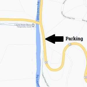
Driving from Asheville: Take I-26 W towards Weaverville for 8 miles. Take exit 19A to merge onto US 25-N / US 70-W towards Marshall. Remain on US 25-N / US 70-W for 21 miles where a medium-sized, gravel parking area is available and the trail begins. If you cross over the Laurel River Bridge on US 25-N/ US 70-W, you have gone too far.