Marshall, North Carolina Historic Markers
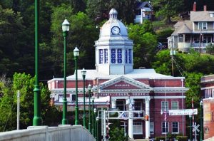
There are two markers in front of the courthouse which address the history which derives from the Buncombe Turnpike’s influence and commemorates the family responsible for the donation of the land for the County Courthouse–the Vances. The others are a short drive from downtown Marshall. The county has a rich tradition in preserving handmade crafts and one of the pioneers in Western North Carolina in that field was Frances Goodrich. The Shelton Laurel Massacre marker continues the story which begins on the Civil War Trails marker down the street from the Courthouse.
ROBERT E LEE DIXIE HIGHWAY
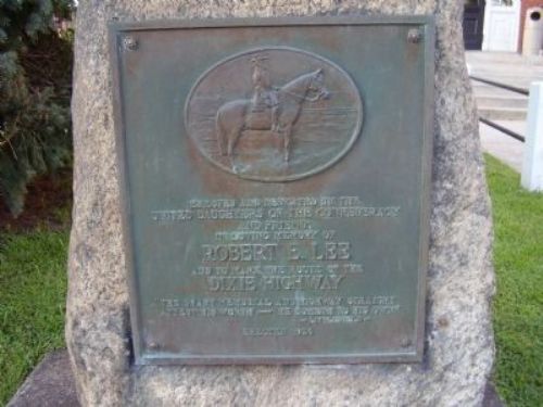
Inscription reads: Erected and dedicated by the United Daughters of the Confederacy and friends in loving memory of Robert E. Lee and to mark the route of the Dixie Highway “The shaft memorial and highway straight attest his worth- he cometh to his own” Littlefield
Location: On Main Street in downtown Marshall in front of the Madison County Courthouse (2 North Main Street, Marshall, NC 28753). GPS Location: 35° 47.851′ N, 82° 41.039′ W
History: The Dixie Highway was first planned in 1914, inspired by the example of the Lincoln Highway. The road was part of the National Auto Trail system and initially was intended to connect the Midwest with the South. However, the final result is more of small network of interconnected paved roads, rather than a single highway. It was constructed and expanded from 1915 to 1927.
The eastern route of the Dixie Highway mostly became U.S. Highway 25 and in Madison County that runs through the towns of Marshall and Hot Springs. Here and in a few other towns in Western North Carolina in the late 1920s, the United Daughters of the Confederacy placed bronze plaques on granite pillars to mark the route of the Dixie Highway (and honor General Robert E. Lee). The other locations are in Asheville, Fletcher and Hendersonville, and on the NC/SC and NC/TN state lines.
BUNCOMBE TURNPIKE
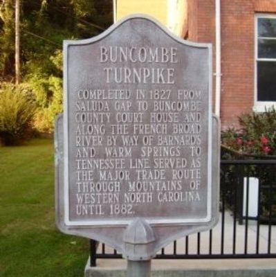
Inscription reads: Completed in 1827 from Saluda Gap to Buncombe County Court House and along the French Broad River by way of Barnards and Warm Springs to Tennessee line. Served as the major trade route through mountains of Western North Carolina until 1882.”
Location: On Main Street in downtown Marshall in front of the Madison County Courthouse (2 North Main Street, Marshall, NC 28753). GPS Location: 35° 47.851′ N, 82° 41.039′ W
History: In 1819, the North Carolina General Assembly initiated plans to build roads in Western North Carolina and a turnpike (The Buncombe Turnpike) along the French Broad River that would connect with a road running from Greeneville, Tennessee to Greenville, South Carolina. The idea was to help farmers get their farm products and livestock to market. When the Buncombe Turnpike was finished in 1827, it was considered the finest road in North Carolina and it was to become the most used road in Western North Carolina. The entire road was seventy-five miles in length and the territory within miles of it benefited economically from it. That economy reversed with the Civil War as resources dwindled and the farmers themselves were killed in battle. Additionally the railroads which met the road were destroyed and the target markets along with them. Although the Turnpike continued to transport people and livestock, its usage never regained its pre-war numbers. Then the arrival of the railroad which allowed animals to be transported quicker and without losing as much weight, quickly replaced the Drovers’ Road in the early 1880s as the main mode of transportation. Today, Western North Carolina’s roads still follow the patterns developed during the era of drovers and the great Drovers’ Road.
DAVID VANCE
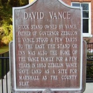
Inscription reads: Stock Stand owned by Vance, father of Governor Zebulon B. Vance, stood a few yards to the east. The Stand or Inn was also the home of the Vance family for a few years. In 1853 Zebulon Vance gave land as a site for Marshall as the county seat.
Location: On Main Street in downtown Marshall in front of the Madison County Courthouse (2 North Main Street, Marshall, NC 28753). GPS Location: 35° 47.851′ N, 82° 41.039′ W
History: Vance’s Stand was one of many along the Buncombe Turnpike (or Drovers’ Road) which ran from the Tennessee state line to the South Carolina state line. A drive of hogs could only go about 8 to 10 miles per day and thus, stands or taverns grew up along the drover’s road to service the hogs and other livestock as well as their drovers. Tollgate records indicate that from 150,000 to 200,000 Tennessee hogs were driven on this turnpike every year in droves of 300 to 3000 head each. David Vance fed 90,000 hogs during one record month.
This land also became important in the “battle” for the location of the county seat. Until an official county seat could be determined, the county court was held at Jewel Hill. The location of the county site at Jewel Hill soon proved unsatisfactory, and the legislature of 1852-53 appointed a commission to fix the plan for a county government. They decided on what is now Marshall for two reasons: David Vance had deeded to Madison County fifty acres of land for a town site, by deed dated April 20, 1853 and that land was close to the Buncombe Turnpike. In the 1854-55 session, the General Assembly passed an act calling for an election to determine the site. There is a tradition that Marshall won by only one vote and that this vote was cast by a man persuaded to go to the polls in return for a package of turnip seeds to plant in his garden.
FRANCES GOODRICH
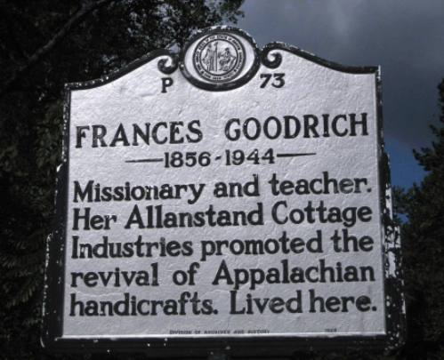
Inscription reads: Frances Goodrich 1856-1944 Missionary and teacher, Her Allanstand Cottage Industries promote the revival of Appalachian handicrafts. Lived here.
Location: On North Carolina Hwy 208, Drive 3.5 miles on NC Highway 208 from the intersection of US Hwy 25/70. Hwy 208 will turn to the left. Go 2.7 more miles to the marker. GPS Location: 35° 96.682′ N , 82° 75.31′ W
History: Frances Goodrich was a pioneer in reviving traditional mountain crafts by adapting them for sale in the contemporary market at the turn of the 20th century in western North Carolina. When she moved to the “Laurel Country” of Madison County in 1897, she noticed that the traditional Appalachian crafts of spinning, weaving, basketry, and whittling were dying out. Goodrich set up Allanstand Cottage Industries as a weaving cooperative in which she paid local women to weave in their homes. Some of the products were sold locally but most were sold as mail order through the Presbyterian Church. Her goals were threefold: to pay local women for their work, to bring money into the community and to preserve the beautiful handmade crafts.
In 1908, she expanded by opening a shop in downtown Asheville where she could take advantage of residential and tourist traffic. In 1917 the business was incorporated and continued its operation for another 14 years. In 1931 Goodrich deeded the property to the newly formed Southern Mountain Handicraft Guild (today’s Southern Highland Craft Guild). In 1935 she followed this gift with another, a collection of regional crafts that form the cornerstone of today’s Southern Highland Craft Guild permanent collection.
The sales shop continues to operate out of the guild’s Folk Art Center on the Blue Ridge Parkway in Asheville where it retains the name Allanstand.
SHELTON LAUREL MASSACRE
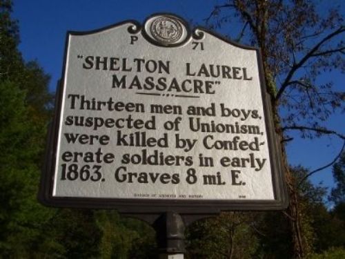
Inscription reads: Thirteen men and boys, suspected of Unionism, were killed by Confederate soldiers in early 1863. Graves 8 mi. E.
Location: Take US highway 25N/70W from Marshall toward Hot Springs to the intersection of NC Highway 208. Marker is on NC State Highway 208 at the intersection of NC 208 & NC 212 3.5 miles from the intersection of US 25/70 and NC 208. GPS Location: 35° 56.1′ N, 82° 44.584′ W.
History: Rations—especially salt which was needed to preserve meats—were in short supply as the Civil War progressed. The situation was especially critical during the harsh winter of 1862-63. Denied these critical rations, Union soldiers from east Tennessee and residents of Shelton Laurel Valley comprised of both Union sympathizers and Confederate deserters decided to make raids onto private property taking salt and other supplies. They entered businesses in Marshall as well as the home of Colonel Lawrence Allen (commander of the 64th North Carolina Infantry). In the Allen house, two of three children were sick with scarlet fever (and those two children eventually died). (Colonel Allen was not at home at the time.) The 64th Infantry under Lieutenant-colonel James Keith was dispatched by General Henry Heth in Knoxville to apprehend the looters. Col Allen was also involved with this. They captured fifteen men (aged from 13 or 14 to 60) although it was later reported that only five of the fifteen were actually involved in the raid. Two escaped and thirteen were executed in January 1863 by firing squad and buried in shallow graves.
Two granite markers memorialize the site. The gravesite itself is not readily accessible as it lies on private property. The first head stone bears the names of: James Shelton, David Shelton, James Shelton, Jr., Azariah Shelton, William Shelton and Rod Shelton. The second head stone bears the names of: Jasper Chandler, Ellison King, Hellen (Hellen is on the stone—his name was actually Halen) Moore, David Shelton, James Metcalf, Wade Moore and Joseph Woods.
The Shelton Laurel Massacre is one of those events where the story has been passed down from one generation to another over a long period of time. There are many “facts” related to this story that have not been documented by good historical research. Also, even primary sources of the time are sometimes in error. We may never know the full true story. The account above was provided by Dan Slagle who has spent many years researching this event. A few books have been written about this incident including Ron Rash’s novel The World Made Straight and Victims: A True Story of the Civil War the non-fiction book by Philip Paludan.

